WWII: Maginot Line | Normandy | V-Weapon Sites | Arnhem
Further afield: Crete
| Home Tracing Military Ancestors Travel Advice CWGC Cemeteries Iron Harvest News Book Reviews Glossary Links Contact Me Maginot Line:
 
|
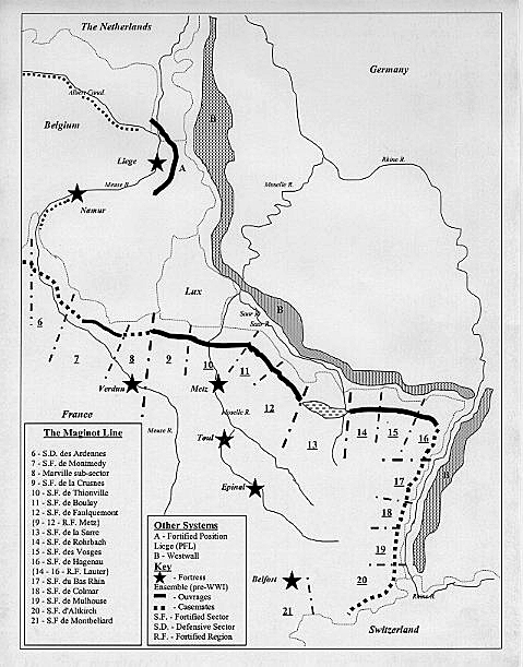
Construction of the LineThe Maginot Line fortifications can be divided into three major sectors – those facing Italy across the Alps, those facing Germany across the River Rhine and those facing the German land border in north-eastern France. It was decided quite early in the planning not to extend the fortifications along the French border with Belgium. This was partly due to the lack of significant topographical features which would form the basis of any such defences in this sector and partly because many assumed the Ardennes region to be an impenetrable barrier for an invading army. In any case, it was felt that the open flank would be where the French Army could concentrate its main forces to engage and defeat the enemy.
Construction began in the Alps in 1928 with the defences against Germany commencing the following year. Over the course of the next six years over 5,000,0000,000 Francs were spent on this immense project, which encompassed:
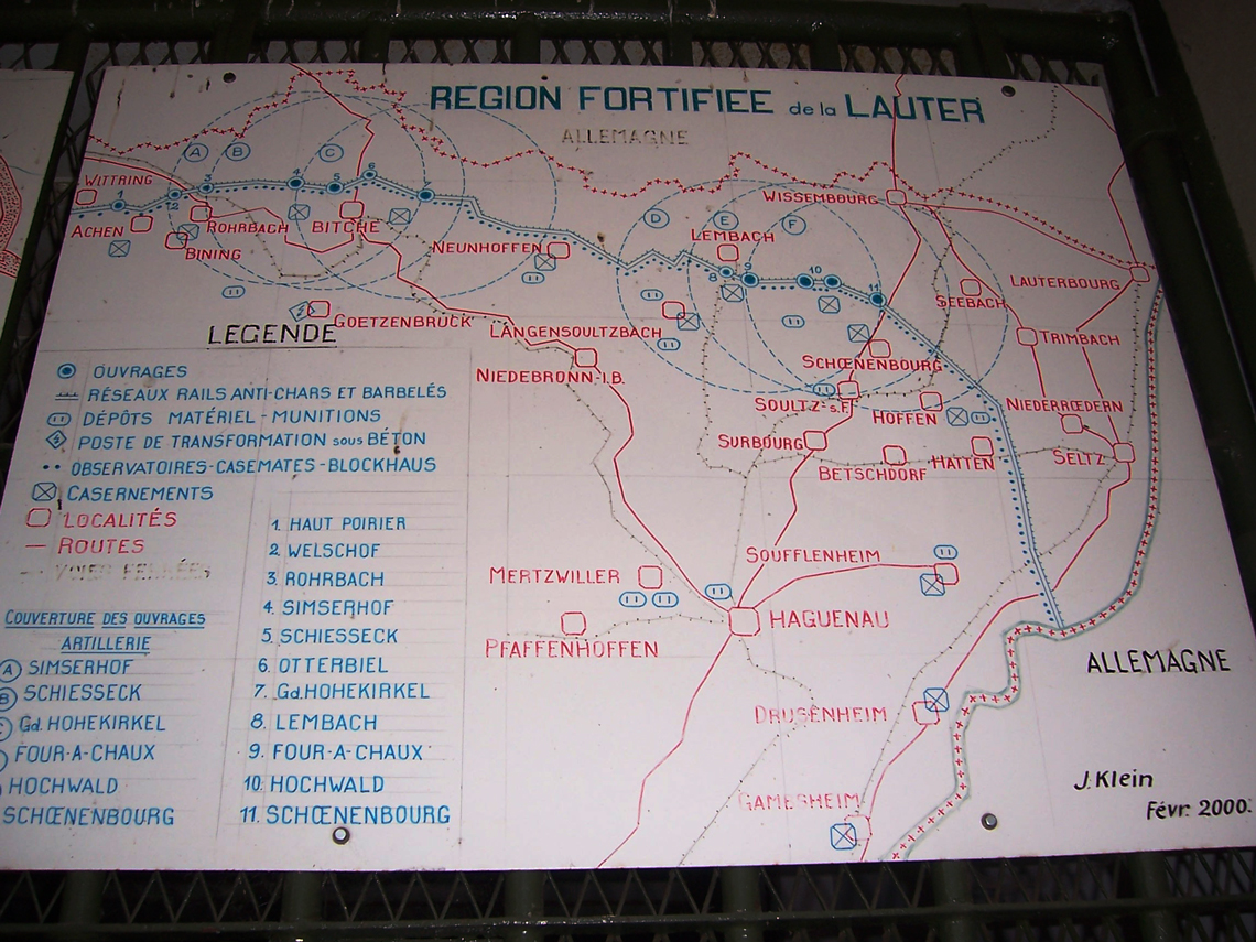
By 1936 the main fortifications were complete. Further additions took place right up to the German invasion in May 1940, but none on the scale of the earlier works. Disposition of the Fortifications The key to the swift construction of the Maginot Line was the design of several standard components, which could be combined together in different arrangements, dependent on topography and local ground conditions, to form a defensive system. On the north-eastern border with Germany, these consisted of a thin network of border posts backed by a series of artillery forts or “ouvrages” which were in turn linked by a string of interval casemates or “casemates de mitrailleuses isolées” up to 10km from the border. These fortifications were enmeshed within systems of anti-tank obstacles and barbed wire. This defensive crust was supported by local reserves of fortress infantry and artillery that could be directed to contain any enemy incursions. The Maginot Line in this sector was divided into two main fortified regions – the Metz Fortified Region covering the Lorraine Industrial Basin and the Lauter Fortified Region covering the River Sarre to the River Rhine.
Along the River Rhine the defences consisted mainly of infantry casemates, similar to the interval casemates facing the German land border. These defences were weaker partly due to the significant natural obstacle the Rhine presented to an attacker, and partly to the fact that the higher water table here precluded the construction of the deep artillery forts that were a feature of the Maginot Line to the north-west. Meanwhile, along the border with Italy, "ouvrages" was concentrated in defending the few mountain passes that were the only practicable invasion routes into France. Only along the low-lying Mediterranean coast was the Line constructed on a similar pattern to that along the German border. |