WWII: Maginot Line | Normandy | V-Weapon Sites | Arnhem
Further afield: Crete
| Home Tracing Military Ancestors Travel Advice CWGC Cemeteries Iron Harvest News Book Reviews Glossary Links Contact Me Ypres:
 
|
Ypres Salient Tour Guide - Optional LocationsFor those that have already visited Ieper before and been to the more well-trodden sites, the following are an additional selection of sites of interest.
Optional Location 1 – Talbot House (Toc H), 43 Gasthuisstraat, PoperingheTalbot House, in the middle of Poperinghe, acted as a refuge for officers and men away from the horrors and traumas of the frontline. It was originally the idea of Reverend Neville Talbot, the chaplain of 6th Division, who was looking for a church club where his flock could receive spiritual nourishment. When he found the property in 1915 he asked an old friend, Reverend "Tubby" Clayton, to take charge of the project. "Tubby" Clayton was a remarkable and resourceful man with an immense sense of humour. He begged, stole and borrowed to kit the house out with a chapel, library, kitchens and rooms where both officers and men could escape from the horrors and traumas of the Front. Above one of the doors was a sign which read, "Abandon rank all ye who enter". The house was named after Neville Talbot’s brother, Gilbert, who was tragically killed in July 1915 during the fighting around Hooge. In the old British Army signalling shorthand Talbot House became "Toc H" (it would now be "Tango Hotel") and this, in turn, gave its name to the charity, which was founded post-war to help ex-soldiers and spread its Christian work in the spirit of "Tubby" Clayton’s club. To find out more about Talbot House and the "Toc H" charity visit www.talbothouse.be.
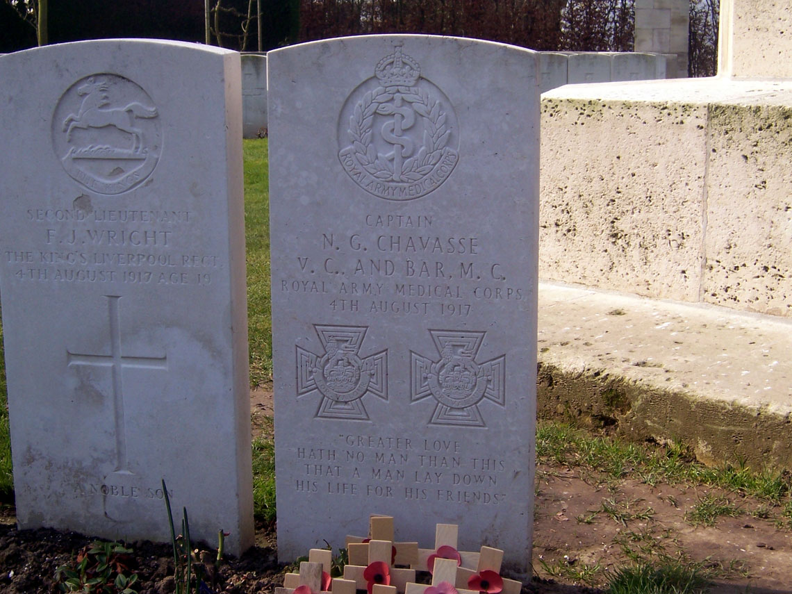
Optional Location 2 – Grave of Captain Noel Chavasse, VC and Bar, Brandhoek New Military Cemetery, BrandhoekFrom Poperinghe, head towards Ieper on the N38 dual carriageway. Within 2.5km you’ll see signs for Brandhoek and its military cemeteries. Turn off the road to the right and right again for Brandhoek New Military Cemetery. The Victoria Cross (VC) is the most famous military decoration in the world. To win one is remarkable. That anyone could be awarded the decoration twice is almost inconceivable. Yet there is an officer buried here who is one of only three to achieve this honour and the only one to win both during the First World War – Captain Noel G Chavasse VC and Bar, Military Cross, Royal Army Medical Corps. Captain Chavasse was the medical officer of the 1st Battalion, Liverpool Scottish Regiment. He won his Military Cross during the fighting around Hooge in 1915 and his first VC for saving the lives, under fire, of 20 wounded at Guillemont on the Somme in 1916. He was awarded his second VC for further acts of outstanding courage - tending to the wounded in the battles of Third Ypres, during which he was badly wounded and later died. His headstone inscription reads, "Greater love hath no man than this, that a man lay down his life for his friends".
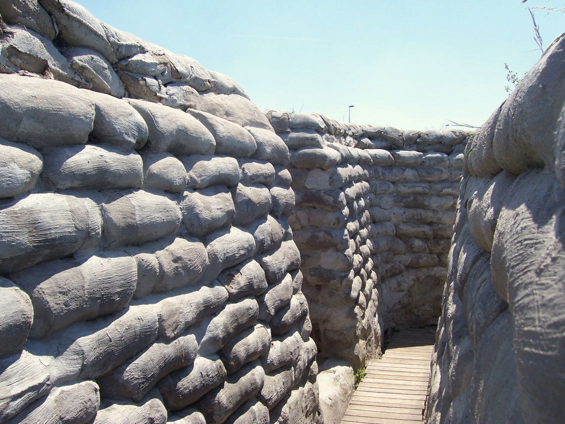
Optional Location 3 – "Yorkshire Trench", BoesingheFrom the N38 travelling eastwards turn left immediately on crossing the Yser Canal north of Ieper. Yorkshire Trench is signposted a few hundred yards further to the right. "Yorkshire Trench" was recently discovered whilst ground-clearing for a new industrial estate north of Ieper. It consists of a section of frontline trench dug by the 49th West Riding Division alongside the Yser canal between 1915 and 1916. When local archaeologists were called in they uncovered significant quantities of material and, sadly, many human remains, which were buried with full military honours at Cement House CWGC Cemetery near Langemarck. Following such a remarkable discovery it was decided to recreate the trench, as it would have looked. The site was opened in 2003 and is free to enter.
Optional Location 4 – Poelcapelle British CWGC Cemetery, PoelkapellePoelcapelle British CWGC Cemetery, with 7,478 burials, is one of the largest in the Ypres Salient. As a concentration cemetery it contains soldiers from throughout the four years of war and from across the Ypres Salient but the majority of graves are of men killed during the four terrible months of the Passchendaele fighting in 1917. Many come from the 11th Division of the British Fifth Army who entered the shattered remains of Poelkapelle village on 4th October 1917 (Poelcapelle is the French spelling of the cemetery). A casualty of the Second Battle of Ypres, Private John Condon, of the Royal Irish Regiment killed on 24th May 1915 is also buried here. At just 14 years of age, he was one of the youngest British soldiers to be killed in the war.
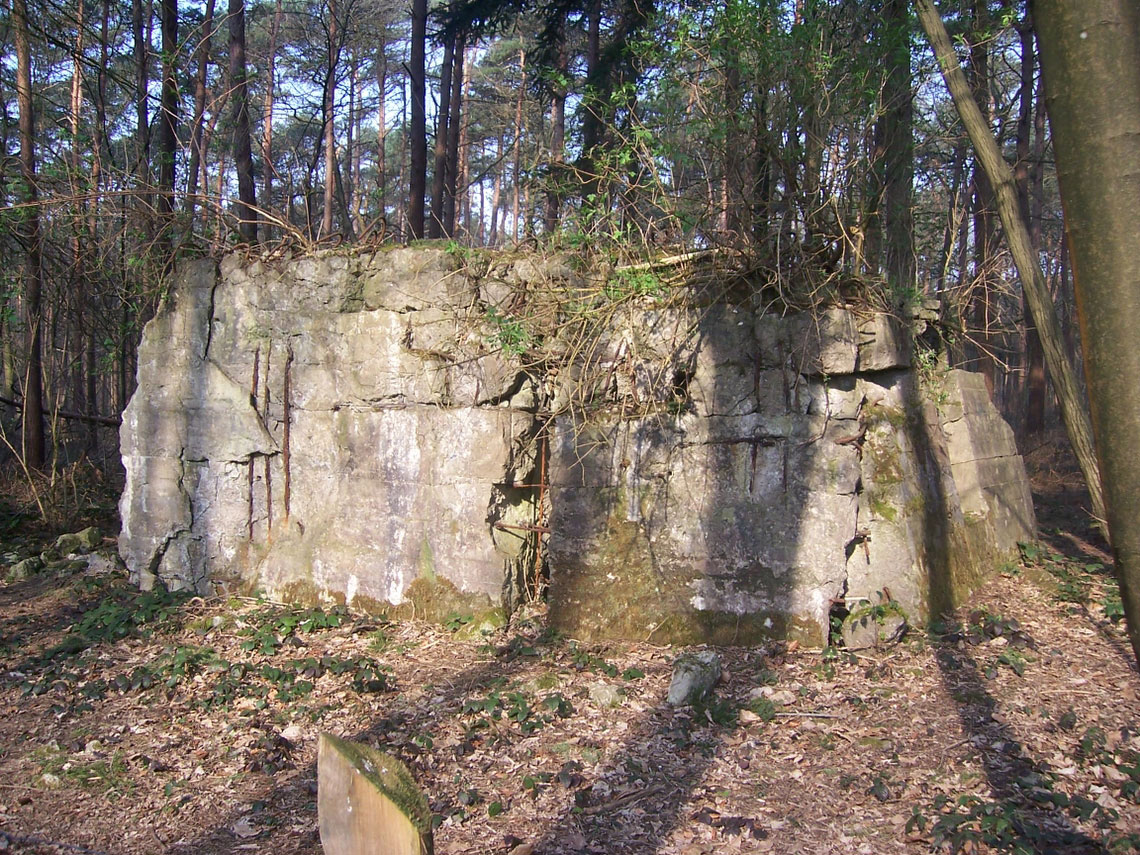
Optional Location 5 – Polygon Wood, south of ZonnebekeTo reach Polygon Wood, leave Zonnebeke on the Beselare road and take the first turning on the right. Polygon Wood is 1.5km further on the left. Used before the war as a riding school and rifle range by the Belgian Army, it was the scene of heavy fighting during First Ypres when the Prussian Guard attacked it. The British held the wood but lost it on 3rd May 1915 during Second Ypres. The 5th Australian Division retook it during 3rd Ypres, and their memorial looms above Buttes New British Cemetery. This cemetery is also the site of the New Zealand Memorial to the Missing. Scattered around the wood are a number of concrete bunkers.
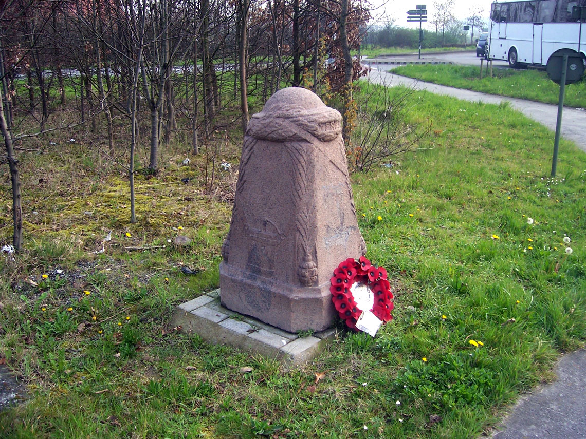
Optional Location 6 – Hellfire Corner, Menen Road, IeperTo find Hellfire Corner, leave Ieper via the Menin Gate and take the right at the traffic lights onto the Menin Road. Continue until you reach a roundabout – this is Hellfire Corner. During the First World War this road intersection was one of the most notorious places in the entire Salient. With roads converging here from Zillebeke, Menin and St Julien, the Germans on the high ground ranged their artillery to bombard any troop or equipment movements through this spot – hence its name. Between the Ieper and St-Juliaan exits is a Demarkation Stone – it records the farthest advance of the Germans in April 1918 and lies barely 2km from the Cloth Hall!
Optional Location 7 – St Eloi Craters, Sint-ElooisSitting as it does on the front line at the northern end of the German-controlled Messines Ridge, St Eloi became a major sector for British mining operations between 1915 and June 1917. The smaller 1915 mines have since been filled in but some of the larger craters remain. One of these, blown on 27th March 1916, can be seen filled with water on the left-hand side of the N336 as you exit the hamlet from the roundabout sign-posted to Rijsel (Lille). The largest, of 95,600lbs of explosive, blown in the Messines Offensive of 7th June 1917, lies behind the houses between the N336 and N365 and can be accessed via a security gate on the right- hand side of the N336 from the roundabout. You will need to call the Tourist Information Centre in Ieper for the code (the telephone number can be found on the gate). Inside a sign-posted trail takes the visitor on a short tour of the area, which includes a British bunker.
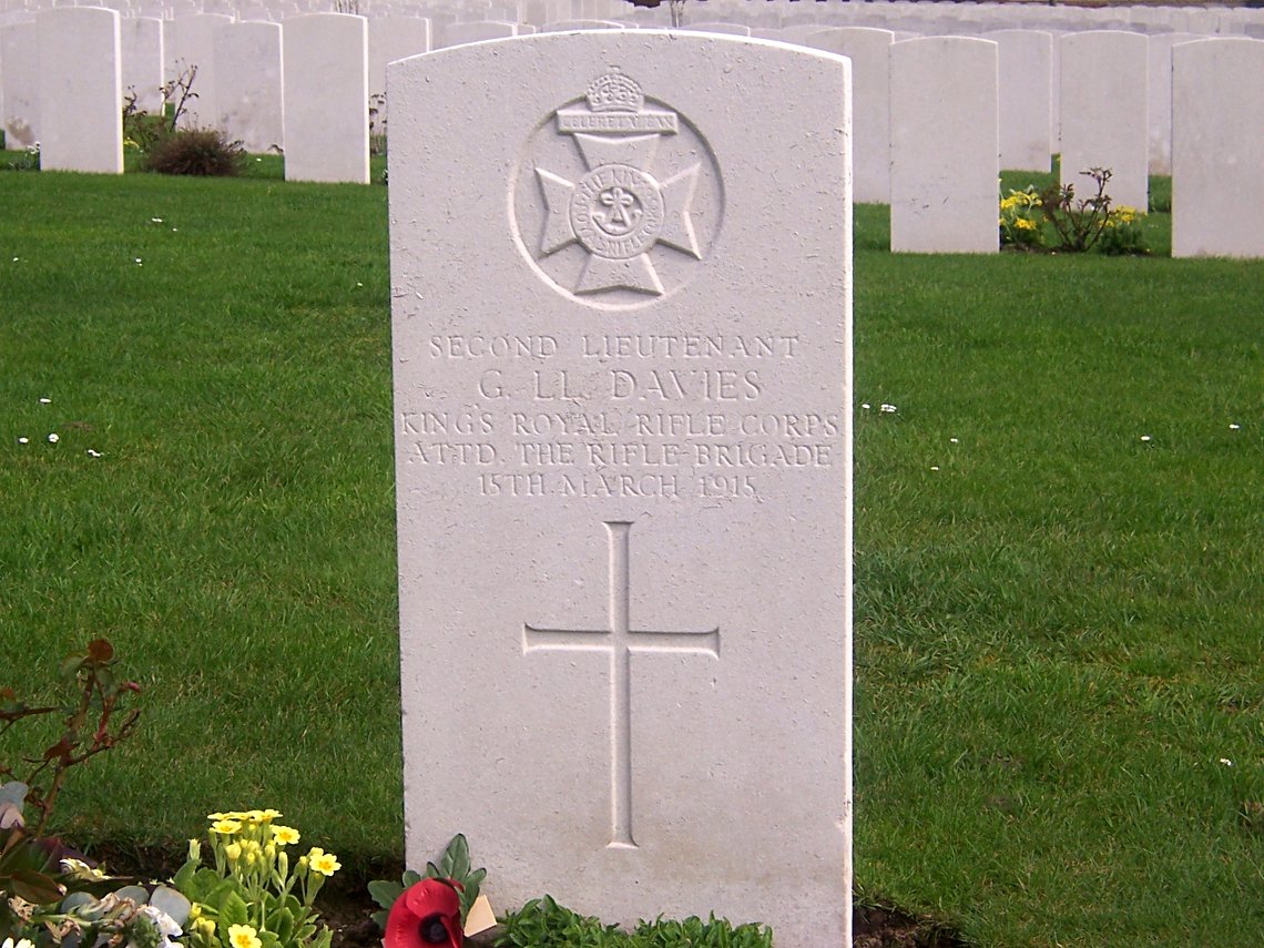
Optional Location 8 – Grave of Lt George Llewelyn Davies, Voormezele Enclosure No 3 CWGC CemeteryTo reach the village of Voormezele, leave Ieper by the N365 to the south and take the first right onto the N331 to Vierstraat. Pass the barracks on the right and take the left turn to Voormezele in 2km. Voormezele Enclosure No 3 CWGC Cemetery is on your left as you enter the village. Buried in this cemetery is Lt George Llewelyn Davies of the 6th Battalion, Kings Royal Rifle Corps. As a young boy George and his brothers were befriended by the playwright, J M Barrie, who, inspired by the boys, combined stories that he wrote for and about them into the book, "Peter Pan". George was killed during a night advance on St Eloi on 15th March 1915 and so became, literally as well as metaphorically, "the boy who never grew up".
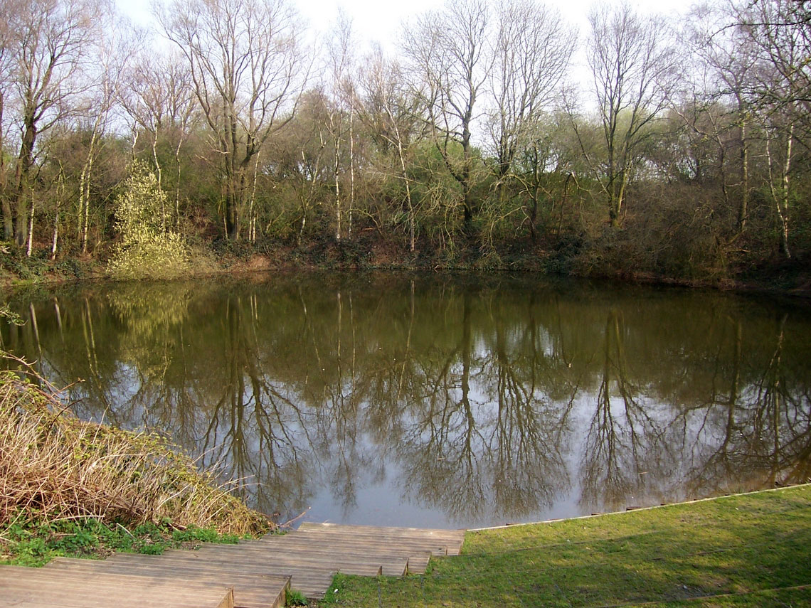
Optional Location 9 – Spanbroekmolen Crater "Pool of Peace" west of WijtschateFrom Wijtschate, take the road signposted to Kemmel, passing Wijtschate Military CWGC Cemetery on the right and, after around 2km, take a left signposted to Lone Tree CWGC Cemetery. On the left is the Spanbroekmolen mine crater, the result of one of the largest charges to be detonated prior to the Messines offensive. The tunnel was begun in December 1915 and extended 300 yards under the German lines. It was packed with 91,000lbs of ammonal with a primer charge of 1,000lbs of dynamite. Unfortunately it went up 15 seconds late and a number of the attacking British troops were caught in the blast wave and killed. After the war, the crater was bought by Lord Wakefield on behalf of the Toc H Charity, was renamed "The Pool of Peace" and left as a memorial for posterity.
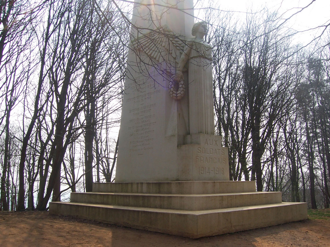
Optional Location 10 – Kemmelberg, south of KemmelFrom Kemmel village follow signs for the Kemmelberg. Soon the road starts to rise - head for the Belvedere at the summit and park outside the café. Kemmelberg is the eastern-most of the oft named, “Flanders Hills”. It was held by the British throughout the war, until it was lost during the German Spring Offensive in 1918 before being recaptured again by the 34th Division in August 1918. There are excellent views of the entire battlefield to be seen for the observation tower and, nearby, is a French Ossuary containing the remains of over 5,000 French soldiers who fought here in 1918.
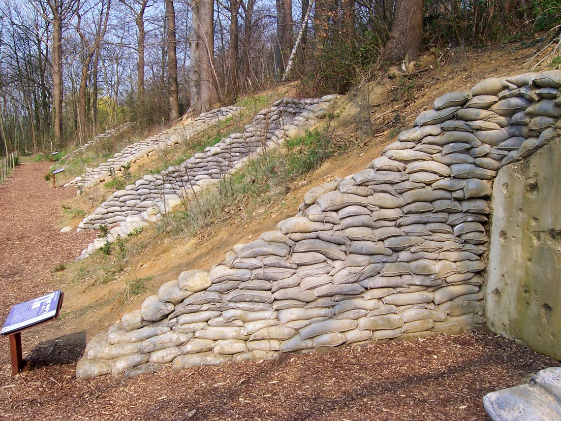
Optional Location 11 – LettenbergThe Lettenberg dugouts are on the northern side of the Kemmelberg on the Loker to Kemmel road. You can see them from the road dug into the spur. They were constructed by the British during 1917 and used for command, communication and medical facilities. They were reopened in 2004 and the third bunker from the road houses a colony of bats!
|
||||||||||||||||